

Satellite Captures Formation of Cyclone Xavier's 'Eye'
Satellite images from GOES-18 on November 16, 2026, documented the storm's development: from a disorganized cloud system to a powerful tropical cyclone with a clearly visible eye at its center.
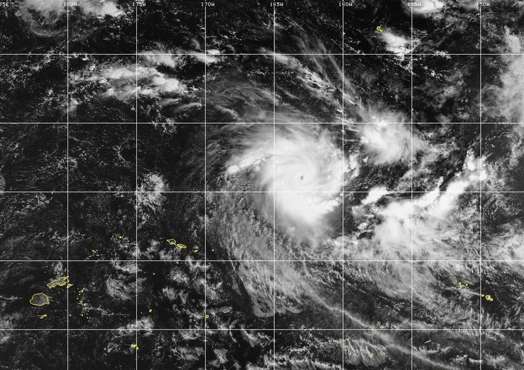
This was reported by specialists from the Cooperative Institute for Meteorological Satellite Studies (CIMSS) at the University of Wisconsin-Madison.
Microwave observations also revealed the formation of distinct rainbands and a stable cyclone structure. According to CIMSS estimates, its intensity increased within just 12 hours from a level close to a tropical storm or Category 1 to indicators on the boundary between Category 2 and Category 3.
At the same time, long-term forecasts suggest a possible significant weakening of Xavier later this week. Meteorological models differ in their assessments of the cyclone's future trajectory: it may pass either east or north of the Samoan Islands. Residents of the region are advised to monitor official meteorological warnings.